Page 1 of 1
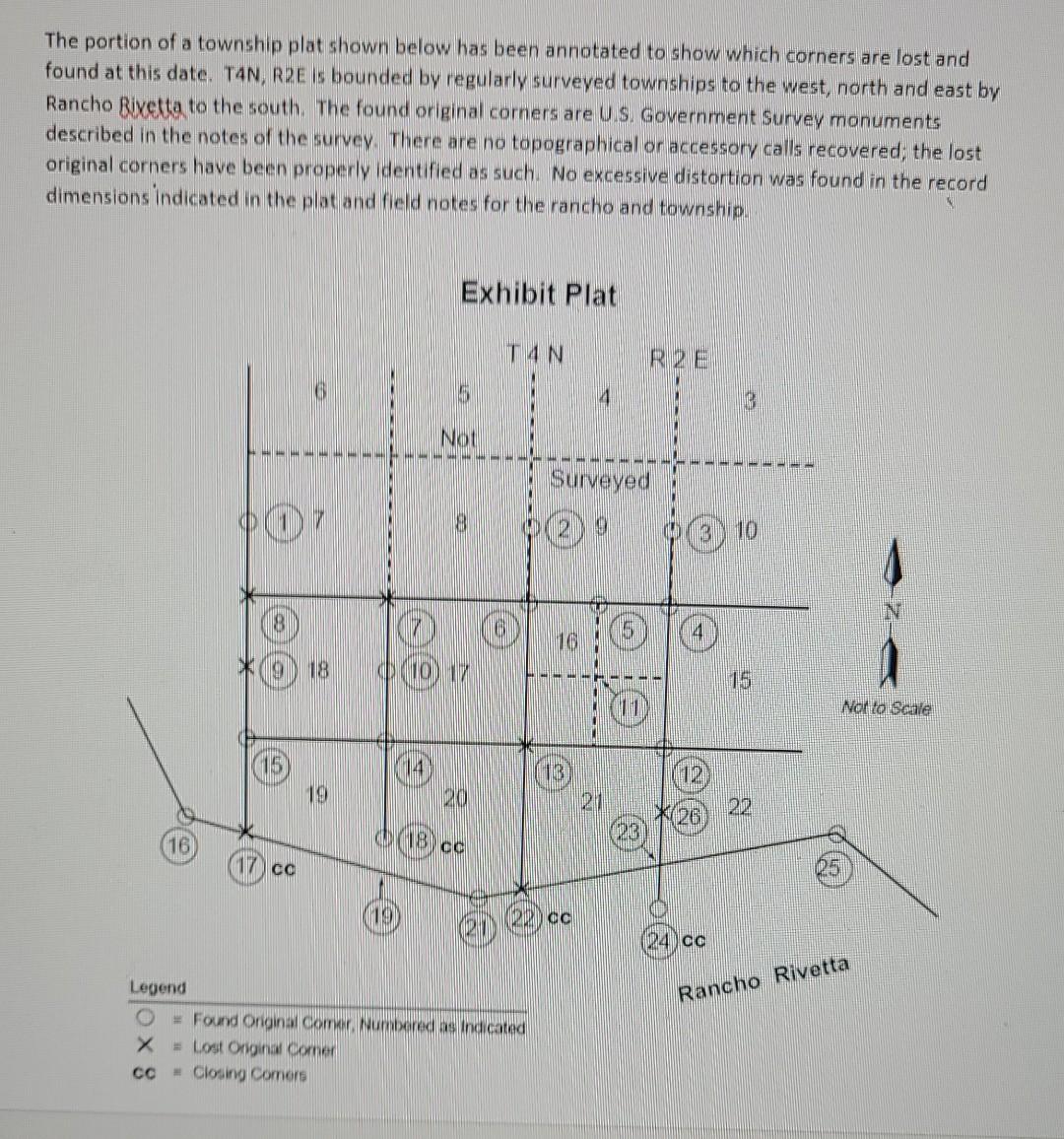
The portion of a township plat shown below has been annotated to show which corners are lost and found at this date. TAN
Posted: Tue Apr 26, 2022 1:51 pm
by answerhappygod
- The Portion Of A Township Plat Shown Below Has Been Annotated To Show Which Corners Are Lost And Found At This Date Tan 1 (236.02 KiB) Viewed 36 times
- The Portion Of A Township Plat Shown Below Has Been Annotated To Show Which Corners Are Lost And Found At This Date Tan 2 (158.68 KiB) Viewed 36 times
The portion of a township plat shown below has been annotated to show which corners are lost and found at this date. TAN, RPE is bounded by regularly surveyed townships to the west, north and east by Rancho Rivetta to the south. The found original corners are U.S. Government Survey monuments described in the notes of the survey. There are no topographical or accessory calls recovered; the lost original corners have been properly identified as such. No excessive distortion was found in the record dimensions indicated in the plat and field notes for the rancho and township. Exhibit Plat T4N Not Surveyed 8 (7 18 DO 17 Norto Scale TB 19 201 201 26 16 IB CC (17 cc 2 da 240cc Rancho Rivetta Legend # Found Onginal comer Numbered as indicated X Lost Ongina comer со + Closing Comors
Explain the procedure necessary to establish the corners in the following order: 8,9, 17, 19, 23, 22, 26, 13, 11, 7.