Page 1 of 1
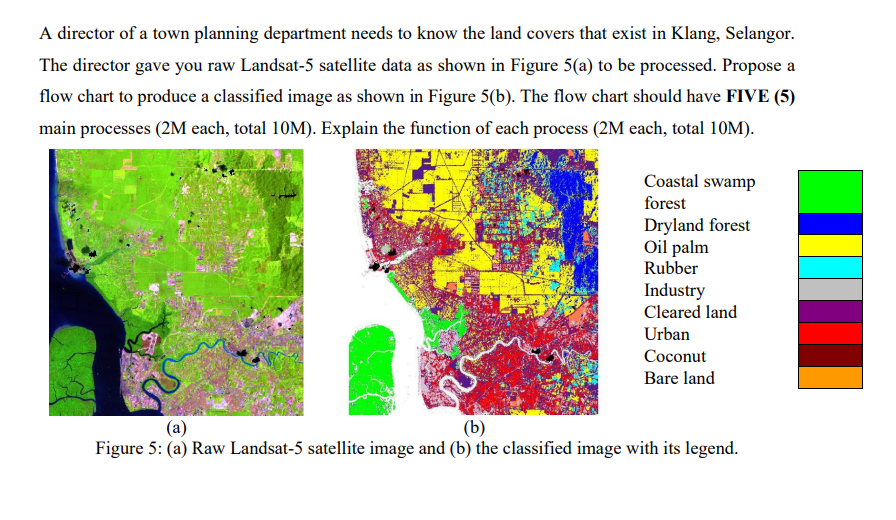
A director of a town planning department needs to know the land covers that exist in Klang, Selangor. The director gave
Posted: Fri Jul 01, 2022 5:47 am
by answerhappygod
- A Director Of A Town Planning Department Needs To Know The Land Covers That Exist In Klang Selangor The Director Gave 1 (504.22 KiB) Viewed 31 times
A director of a town planning department needs to know the land covers that exist in Klang, Selangor. The director gave you raw Landsat-5 satellite data as shown in Figure 5(a) to be processed. Propose a flow chart to produce a classified image as shown in Figure 5(b). The flow chart should have FIVE (5) main processes (2M each, total 10M). Explain the function of each process (2M each, total 10M). Coastal swamp forest Dryland forest Oil palm Rubber Industry Cleared land Urban Coconut Bare land (a) (b) Figure 5: (a) Raw Landsat-5 satellite image and (b) the classified image with its legend.