Page 1 of 1
Checklist of your report: 1. Describe the plan of the control network. Where are the control stations? What details are
Posted: Wed Jun 08, 2022 6:42 am
by answerhappygod
- Checklist Of Your Report 1 Describe The Plan Of The Control Network Where Are The Control Stations What Details Are 1 (697.33 KiB) Viewed 56 times
- Checklist Of Your Report 1 Describe The Plan Of The Control Network Where Are The Control Stations What Details Are 2 (96.05 KiB) Viewed 56 times
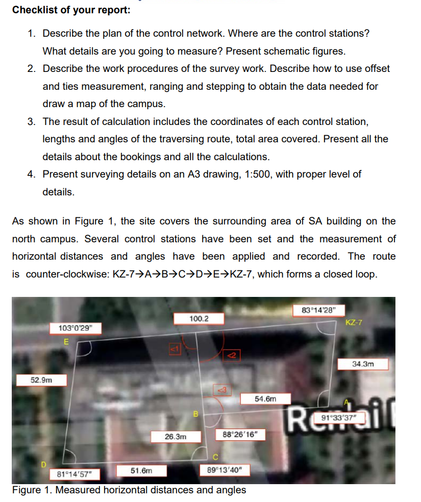
Checklist of your report: 1. Describe the plan of the control network. Where are the control stations? What details are you going to measure? Present schematic figures. 2. Describe the work procedures of the survey work. Describe how to use offset and ties measurement, ranging and stepping to obtain the data needed for draw a map of the campus. 3. The result of calculation includes the coordinates of each control station, lengths and angles of the traversing route, total area covered. Present all the details about the bookings and all the calculations. 4. Present surveying details on an A3 drawing, 1:500, with proper level of details. As shown in Figure 1, the site covers the surrounding area of SA building on the north campus. Several control stations have been set and the measurement of horizontal distances and angles have been applied and recorded. The route is counter-clockwise: KZ-7→AB⇒C⇒D⇒E⇒KZ-7, which forms a closed loop. 83°14'28" 100.2 KZ-7 103°0'29" 52.9m 26.3m C D 51.6m 89°13'40" 81°14'57" Figure 1. Measured horizontal distances and angles 54.6m 88°26'16" 34.3m Repail 91°33'37"
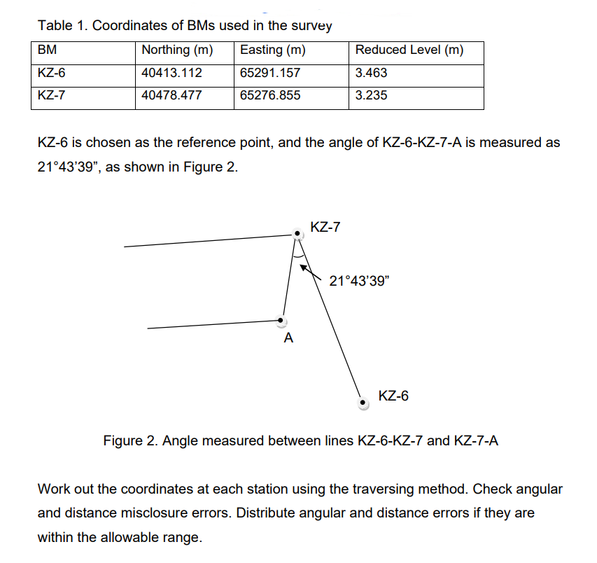
Table 1. Coordinates of BMs used in the survey BM Northing (m) Easting (m) Reduced Level (m) KZ-6 40413.112 65291.157 3.463 KZ-7 40478.477 65276.855 3.235 KZ-6 is chosen as the reference point, and the angle of KZ-6-KZ-7-A is measured as 21°43'39", as shown in Figure 2. KZ-7 A KZ-6 Figure 2. Angle measured between lines KZ-6-KZ-7 and KZ-7-A Work out the coordinates at each station using the traversing method. Check angular and distance misclosure errors. Distribute angular and distance errors if they are within the allowable range. 21°43'39"