Page 1 of 1
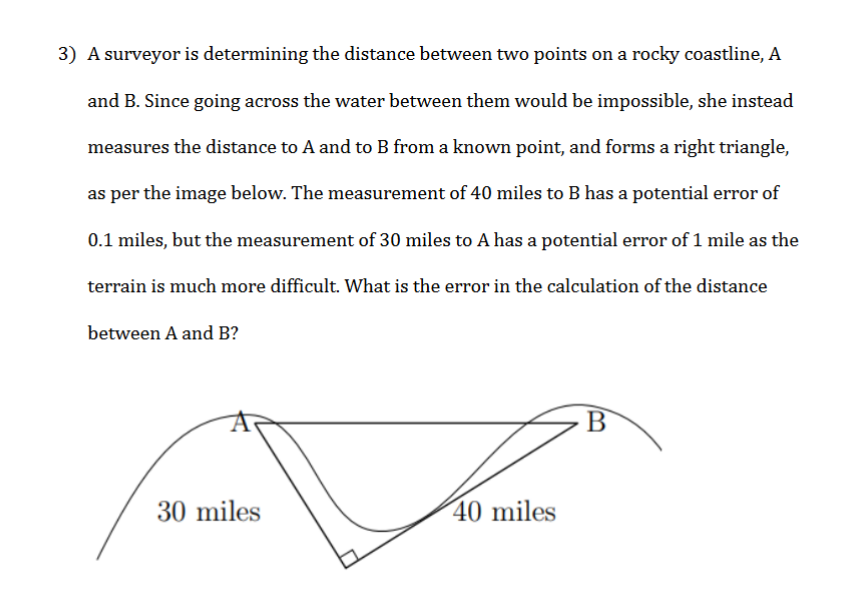
3) A surveyor is determining the distance between two points on a rocky coastline, A and B. Since going across the water
Posted: Tue Jun 07, 2022 5:52 am
by answerhappygod
- 3 A Surveyor Is Determining The Distance Between Two Points On A Rocky Coastline A And B Since Going Across The Water 1 (128.44 KiB) Viewed 45 times
3) A surveyor is determining the distance between two points on a rocky coastline, A and B. Since going across the water between them would be impossible, she instead measures the distance to A and to B from a known point, and forms a right triangle, as per the image below. The measurement of 40 miles to B has a potential error of 0.1 miles, but the measurement of 30 miles to A has a potential error of 1 mile as the terrain is much more difficult. What is the error in the calculation of the distance between A and B? B 30 miles 40 miles